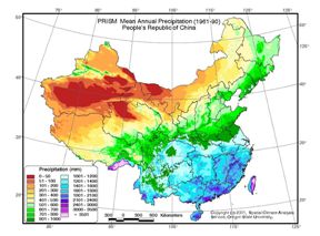
오레곤 주립대학의 '중국 농업의 미래의 시각화: 더 나은 의사결정을 위한 기후, 토양, 적합성 지도'

Medford News에 의하면 오레곤 주립대학의 두 과학자들이 최초로 중국대륙 전체의 기후, 토양 특성, 식물 적합성을 다룬 광범위한 지도 콜렉션을 만들었다고 한다. 다음은 그 기사에의 링크.
Oregon State University Scientists Introduce Lavishly Illustrated China Atlas - (Medford Article) Oregon State University scientists have created a unique new kind of atlas that lavishly and literally maps the results of a 10-year research partnership between the People's Republic of China, OSU and the Oregon grass seed industry.
댓글